So the start was a walk down to Kingston town itself. In fact what I assume to be the original heart of the town where the Hogsmill meets the Thames. Modern tradition has it, and I'm not sure how much of this is supported by sources, 7 Anglo-Saxon kings were crowned here in the 10th century. This included the first king of all England, Athelstan.

Once down on the Thames we turned upstream for a short distance until we cam to the mouth of the Hogsmill. The area around there is almost all turn of the millenium development, including a tidy looking complex of walkways and little islands where the Hogsmill enters the Thames. Not the prettiest of sights but it is designed to encourage wild-life as well as commercial life (there are lots of bars and restaurants in the area).


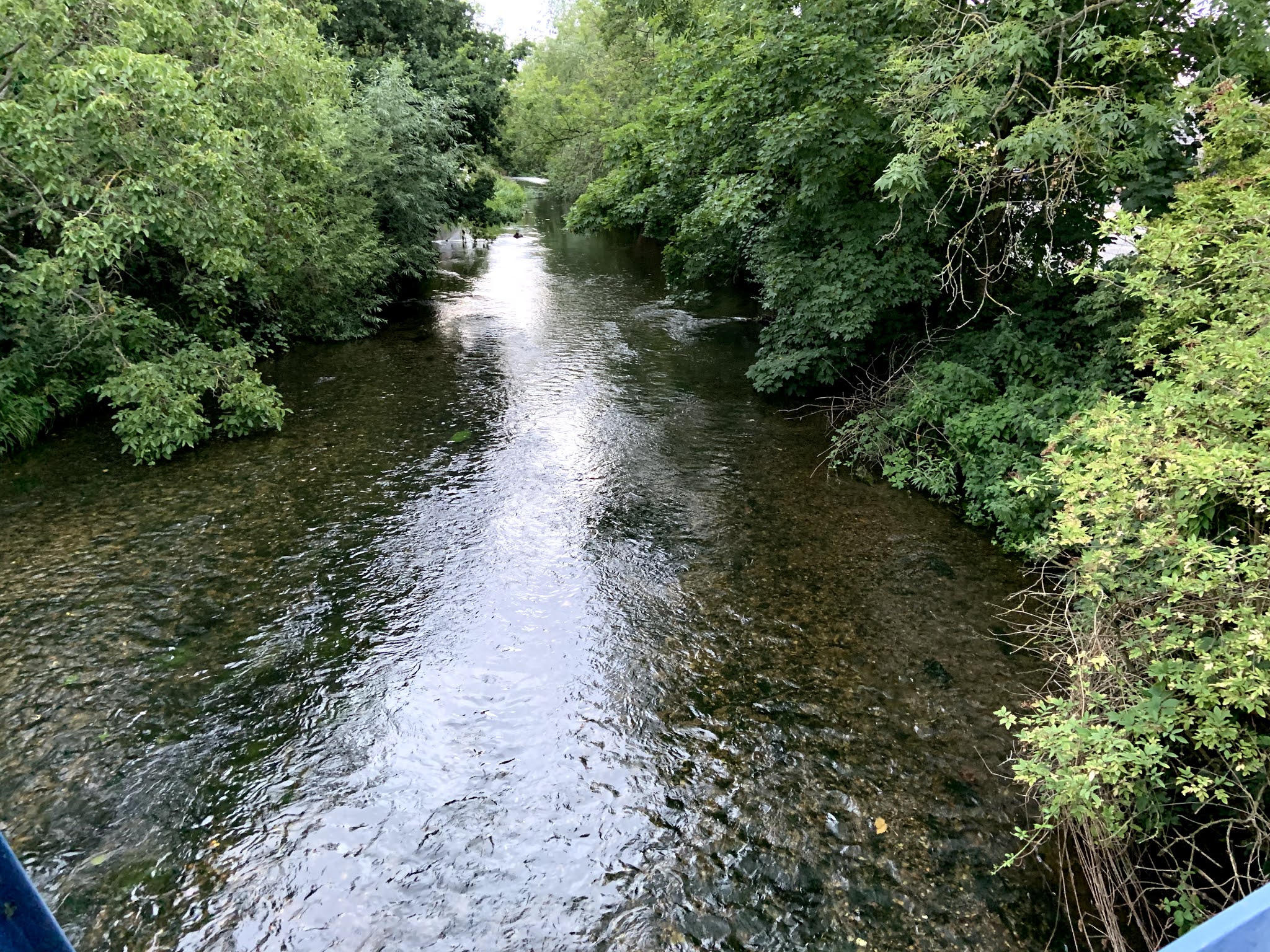
A short stroll up the Hogsmill brings you to the 12th century Clattern Bridge. It looks old but it doesn't look that old because it's been built up over the centuries. There's fabulous 18th century map of the town on the Wikipedia page which just screams 'wargaming scenarios' to me.

On the map on the opposite side of the Thames from Kingston you can see the edge of Hampton Court Palace Park on the right. The open land under Hampton (this settlement is known as Hampton Wick now, Hampton proper is a couple of miles away) is Bushy Park, another large Royal Park close to where SHAEF HQ was and the NPL is. There's also an eyot downstream of Kingston Bridge (left on the map) which no longer exists. Top left on the map is a farm (Canbury) which is roughly where the Hawker factory was mentioned in a previous post. I also learnt from the Wiki entry that there was an annual game of football played on Shrove Tuesday between Clattern Bridge and Kingston Bridge which legend has it dated back to the 8th century but was ended in the 19th century by busybodies.
 |
| The Clattern Bridge looking downstream towards the Thames. |
Back to the walk. Close to the Clattern Bridge is the administrative centre of Kingston where the Guildhall (borough council HQ) and police station are located. But more interestingly the area holds this, which is supposedly the English version of the Stone of Scone. Again I don't know how true this is, but it's a nice thought.

 |
| Next time I'll try to remember some wipes |
Continuing upstream from the Guildhall there are some nice views, nothing spectacular but nice to see in a built up area. Much of the stretch around here, an area formerly inhabited by flour mills, is occupied by the University of Kingston. On one of the islands there's also a community garden for the local flat dwellers. Whilst most of the river has steep banks (often concrete) there are places where you can walk down to the waters edge, which I pointed out to Daughter III as a nice place to hang out.
 |
| One of a number of weirs on this stretch |

 |
| A peak through the fence at the community garden |
As photogenic sights go, that's about it for this stretch of the Hogsmill. A couple of hundred metres later you read Villiers Road which presumably honours the Duke of Buckingham's young brother killed at the Battle of Surbiton in 1648. There are a couple more street names in the locality connected with this, Villiers Avenue, Villiers Close and Buckingham Road. Nothing to the actual victor, Sir Michael Livesey, though. Bloody Royalists.
You cannot walk along the Hogsmill at this point until you rejoin it at Green Lanes Park, after the local sewerage works - I pointed out to Daughter III that that smell comes from something which is one of the biggest contributions to life expectancy in human history.
Later in the week we intended to walk along the stretch of the Beverley Brook that lies within Richmond Park, but got distracted by a footpath that we didn't know about before. We followed it all the way (about a km) to Putney Heath then swung in through Roehampton, the location of the flats referred to in this post from 3 weeks ago Country or city? Going round the block. As well as the tower blocks, there is a wide variety of low rise blocks, and small house (including a few 1 storey buildings, not too dissimilar from those Post-War prefabs). The only riverine stretch of that walk was crossing the Beverley Brook back in Richmond Park. Daughter III and I cooled our feet off by walking through it barefoot while Äiti used the bridge.
One final stretch of water that I walked (yesterday) was a short section of the Longford River. This is an artificial river built to embellish Bushy Park. It was a Red Letter Day for me. I was walking this route back home from Hampton Pool (open air swimming pool) which reopened on Friday. I'd been waiting for that day for four months, and it didn't disappoint. The weather was perfect, the arrangements for ensuring that swimmers were safe were impeccable. The swim was hard as I haven't kept my arms in condition and tiredness meant that my breathing soon went to pot. But this is one of the things that I like about swimming. It's largely a matter of getting control of your mind and body and forcing yourself to do things properly. You know you are getting it right when it feels like you are swimming downhill. I was a happy boy.
An inviting tour of your homeland, sir! The place looks very tranquil.
ReplyDeleteThank you!
It’s not very tranquil at all I’m afraid. Certainly not by your standards. But we have to take what we find, living in the biggest conurbation in Western Europe.
DeleteBut it’s certainly steeped in history. And I’ve found there’s more of it than I realised before I started these walks.
"Conurbation." Now that is a term I had not seen before.
DeleteNice highways and byways! I know what you mean about the map!
ReplyDeleteBest Iain