In my continuing efforts to keep active pending the re-opening of my preferred swimming spot, I've been continuing my daily walks. Sunday and Monday saw two new walks from my own doorstep in different directions to the ones I've been doing.
Sunday, shortly after lunch*, Rouva Nundanket and I left the Schloss (or Linna as she insists on calling it) and met Lincolnshire Tom and his wife in West Wimbledon with a view to having a walk around Wimbledon Common. The walk proper started along the banks of the [corrected text here] Beverley Brook, a tributary of the Thames which runs through one side of Richmond Park and eventually into the Thames near Putney. Sadly we spotted no small creatures collecting rubbish (maybe like doggers they come out after dark) but did come across this splendid war memorial to the north of the common.

Better pictures can be seen here:
Heading slightly further south we then came across another small monument in the form of a short obelisk (do correct me if that's the wrong term). One side was an inscription to the Queens Royal Surrey Regiment (which was latterly merged into the Princess of Wales's Royal Regiment). The reverse was a memorial to the Tangier Regiment which had paraded on nearby Putney Heath. Well spotted Tom!
 |
I wanted to have a gander at 'Caesar's Camp' at the southern side of the common, and as this was heading back to where we wanted to end the walk it was easy to persuade the others to walk that way. Somehow all way finding methods failed us (or more accurately, we messed up) and were about to give up. and were heading for a way out. This involved climbing a fairly steep slope and then just as we found a path that went through a golf course we came across it. it seems that the golf course is slap bang on the 'camp', which was in fact an Iron Age hill fort. Being under the golf course we couldn't actually see much of it.

 |
| This is looking in the opposite direction to the plaque above. The ground drops away steeply forward and to the left here so I assume it’s the ditch of the earthwork. |
This is on a pretty high spot, and you can see why the fort was up there.
 |
| Tom was excited to note that you could “see Tolworth Tower from here”. Not that it’s on this picture. |
 |
| But here, thrill seekers, you can see the famed twin towers of New Malden. Down below is the valley of the Hogsmill. [correction! Below is the valley of the Beverley Brook. What an embarrassing mistake to make.] The river is between this ridge and another lower one before you get to the towers. Roughly 60 degrees right of this view are two higher points, Coombe and Kingston Hills. |
Monday we decided to head in a different direction and much to one of our daughter's annoyance, we said were walking to a park where she has taken to hang out this Summer. Nothing special but it borders the Hogsmill River, which is a tributary of the Thames that flows through Kingston. I wanted to see if I could make it into town all the way along the river bank. I referenced the Hogsmill before in my post on the Battle of Surbiton, 1648. Back then I wondered whether the powder mills shown on the map were around in the Civil War. I discovered this evening that they made powder for the Napoleonic Wars. You can see the Hogsmill just to the east of the area I circled as possibly being the site of the Surbiton battle.
When we got to the park we thought we'd cross to the western side via a footbridge and head over towards Berrylands and Surbiton. Then we spotted the pleasant looking open space heading upstream (later discovered to be 'Elmbridge Meadows'). We followed this for maybe half a mile when the path ended at the busy A3 (3 lanes on each carriageway). We were given directions to an underpass and then eventually found the continuation of the river and more open space on the other side. After about 3/4 of a mile, and a steep incline towards the end) we came to the parish church of St John the Baptist, in Old Malden* close to where the powder mills are shown on the Surbiton battle map.
 |
| Beware of dragoons. |
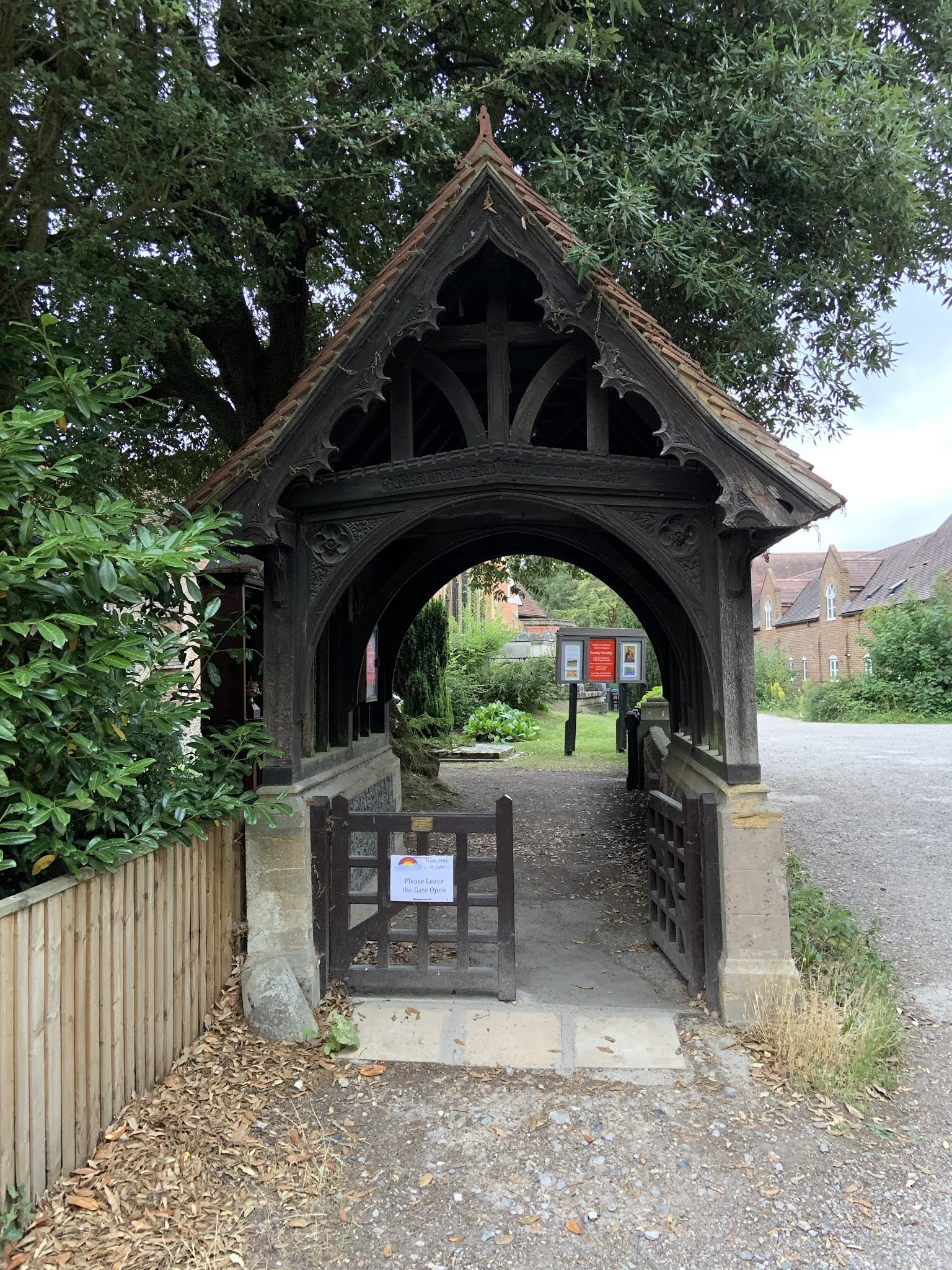
The church itself was worth seeing. It had this lovely Lych Gate:

And this beautiful little war memorial. I've never seen one like this before.

Here is a shot of the church which show at least 3 distinct periods of growth/redevelopment. You can see where it was rebuilt in brick in 1611. The oldest part is Saxon.

All in all a couple of interesting little finds for a geek like me.
At some point I hope to carry on following the Hogsmill up to its source near Nonsuch Park, where a palace was built under orders of Henry VIII. The palace was demolished in the late 17th century, so it would have been around at the time of the Civil War. I don't know how long the walkways continue for, and I expect that the journey will entail a bit of walking along roads. But you never know what's around the corner.
* Until the 1870s this was just 'Malden'. With the coming of the railways, a classic railway suburb (New Malden) sprang up a couple of miles to the north. New Malden became the main settlement in the area and someone thought it necessary to add the qualifier 'Old' to 'Malden'. Maybe estate agents were marketing it as quaint village even then.
Late edit: Because of my initial misnaming of the Beverley Brook as the Hogsmill, there's scope for confusion. I've therefore added the map below which shows the area in the early 19th century. I used the same map in my post on the Battle of Surbiton. The blue annotations show the area of my Sunday walk, and red shows the area of my Monday walk.

Publish all of the travelogues of your area you want. I enjoy them all!
ReplyDeleteMore will come no doubt Jonathan. I'm enjoying linking up various places where I've been before, but have driven around the bits in between. There's a moral in there for me.
DeleteThank you for this enjoyable derive ( French should have accent but I don’t know where to find it on the keyboard) and the accompanying pictures. Years ago I took my class to see the war graves in the local cemetery on November. While we were there a van drew up from the organisation that maintains such graves. He went about his business with great diligence and spoke movingly to the pupils about his job and the importance he placed in it. On a different matter, if one could time travel that mustering of the Tangier Regt must have been a sight to behold. The wooden war memorial is splendid and new to me too. A labour of love.
ReplyDeleteSerendipity at work!
DeleteExcellent - really enjoyed the walk and the pictures. Any amount of this will be most acceptable. Thanks!
ReplyDeleteThanks Tony. They would be even better if I got the names of the watercourses correct. I've added a map to make amends.
DeleteInteresting post. You might find this WW1 era 'military' map of interest of Richmond Park:
ReplyDeletehttps://tabletopscoutingwidegames.wordpress.com/2020/01/19/richmond-park-vtc-map-1916-1917-ww1/
Thanks Mark. I had a quick look and it all seems familiar apart from the ploughed land! The website looks like it’s worth digging into too so I’ll have a good read after work. Scouting Wide Games sounds intriguing.
DeleteReally like the church and the wooden war memorial is unusual isn't it?
ReplyDeleteBest Iain
It looks like it was designed for inside doesn’t it? Quite moving because it’s on such a personal scale.
Delete